Showing posts with label Highway 101 Oregon. Show all posts

Thursday, December 18, 2014

Highway 101 - Winnemucca to the Sea Highway - Nevada Hwy 140...

Day 6 - two days after Thanksgiving and our trip back to Central Utah...


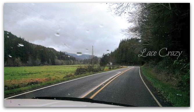
From getting the sheep in Days Creek, OR - we rushed like the wind to make it to Lakeview, OR for the night. I had rented a room at the "Hunter Hot Springs Resort" in Lakeview.  It was AWFUL and not very clean. Anyway - from Days Creek to Lakeview is quite a drive. It's even worse in bad weather.

From Central Point, OR to Klamath Falls we ran into snow on and off and it was dark by the time we got to Klamath Falls. From Klamath to Lakeview seemed to be a lower elevation because we got out of the hard snow, thank goodness and into the rain. Maybe, not a great thing because we almost hit a 2 point deer. It was a really close call - Yikes...

We rolled into Lakeview,OR about 10:30 pm to a really nasty motel room - yuck~!

Do not stay at the Hunter Hot Springs Resort in Lakeview, OR - Ever~!

The next morning - the 6th day of our trip, we made our push to Central Utah. We had about a 750 mile drive ahead of us. About 13 to 14 hours to go. Lakeview, OR is about the last town before Winnemucca. There are a few little, small, farming communities along the route and that's all. 


From Lakeview, OR to Winnemucca, NV is 215 miles and 4.5 hours of desert. 


The Nevada part of the Winnemucca to the Sea Highway is Nevada desolation at its finest...


We seen 7 vehicles on the whole route... 

And, for those wondering - it's restricted to 65' units. That's because of all of the twisty turns in places along the route. For the most part, it's just desert. It's a good road, nothing to worry about regarding the surface. It's 2 lanes in good condition. It's just desolate.

As a word of caution - there are extensions on the delineator poles in places on this section of Highway 140. If you're not from this area, I would not recommend you travel it in bad weather. There's a reason they put these big extensions on. It's  for the snow plows to stay on the road when they're plowing and my suspicion is that this road isn't well maintained in in-climate weather. It's probably one of the last to see a snow plow, so just don't do it. Make sure it's clear before you traverse it in the winter...


There are a few online forums and blogs that talk about this area of Highway 140 being scary. There are 2 areas that might intimidate some. I'm scared of heights and I would drive this portion of Highway 140 alone. I would drive it towing a trailer and not be too worried. To me it seems like a whole lot of 'hype' online, but I'm from Utah and drive through major elevation changes all the time.

This road is nothing to be scared of, aside from its desolation...


Coming from Oregon toward Nevada, when you get to the first 'dugway' (Doherty Slide,) there is no guard rail - as is stated on some other blogs. It's a bit 'windy,' but it's not 'straight off' the edge. At least I didn't think so. You can see the Dougherty Slide dugway in the pic below. It's just an elevation change, not a major deal.

There is no guard rail on this dugway, but the road has a good shoulder on the outside edge. It's so rural, you could use both lanes if you're scared. I didn't find it to be intimidating and I was on the outside edge...


The next dugway some find 'scary' is a ways down the road, closer toward Winnemucca.. It is a bit intimidating. Again, going toward Winnmemucca from Oregon, you will be in the outside lane, but it's a desolate highway, use the whole road~!


Going down this 8% grade did make me tense up a bit, I'll admit, but there's a nice guard rail. It is straight down in places - yes, just don't look if you're scared of heights. Perhaps, this is the one stated online as "scary?" Neither dugway is a reason NOT to travel this road. There's nothing dangerous about it. It's just a couple elevation changes - no need to panic...

Don't take this route in a semi~!

I'm a truck dispatcher and Highway 140 comes up as a primary route on motor carrier mileage software from NV to OR - don't believe the software. 
Highway 140 from Winnemucca to Lakeview, OR is a restricted route for a reason. 
It's because of all of the tight corners!


Aside from 2, 8% grades (the 2 dugways) the road is pretty much non-dramatic. It's very, very rural, so make sure you have a full tank of gas. There is nothing between Lakeview, OR and Denio Junction, NV and the pump in Denio looks questionable - I'm not sure it even works. The 'Man-Child' did go in and get us a cup of coffee. He said the restaurant and shop look much better inside, than outside. From the exterior, the amenity at Denio looks kind of like the Bates Motel - (=


Once you get to Denio, you'll start seeing more traffic. From Denio to Winnemucca you start to feel like you're getting back to civilization.


Personally, I think this route is more desolate than Highway 50 in Nevada. And, there is no cell service along the route with AT&T. Just make sure you have enough fuel and water and get rolling. Nothing to fear. It's actually awesome to know there are places like this still in America. I enjoyed this part of the trip and it was good to get back to Nevada - back to dry weather from all the rain we experienced in Oregon.

There is some good information at This Link about the Winnemucca to the Sea - Highway 140.

We used Highway 140 to get home, not as a scenic byway. We used it to get back to Utah because there isn't any other 'quicker' way out of Oregon to Nevada.  We're from rural central Utah, so desert desolate driving in Nevada is like being home for us, so it was no big deal...

We had a wonderful trip~!

Tuesday, December 9, 2014

Highway 101 - Southern Oregon... (Day 5 - The day after Thanksgiving)


We woke up early this morning, before dark. We wanted to get all of our things packed up and ready to roll. Today was our last day in Charleston, OR and our last day on the coast. We were heading to River Bend Ranch in Days Creek OR to pick up our new St. Croix hair sheep, but not before one more sunrise on the coast...

We left the horse trailer parked in the large parking lot at the Inn and headed back up the Cape Arago Highway to Sunset Bay.

We stopped at Davey Jones Locker in Charleston to get coffee on the way and 'The Man-Child' grabbed us a sausage and egg biscuit. They were homemade and piping hot and yummy~!


Of course, it was STILL raining...
I was feeling like a wet dog. Pretty sure, I sort of smelled like one too with all this wet hair...


We took some time here at Sunset Bay to just goof around on the beach with nobody around, but us...


The tide was going out and then, it would come right back in and it was getting darker, instead of lighter. The 'Man-Child' told me a bigger storm was coming in, the way the ocean was acting.


The 'Man-Child' finally found me a sea shell. Well, a clam shell. It was the only shell we found through this whole trip! It washed in with the tide right before we left Sunset Bay. I felt special when he handed it to me and you could tell where a sea lion had taken a bite out of it, to eat the clam that was inside.


Swarms of seagulls were starting to fly in and land on the beach and in a protected part of the bay.


As I was getting a picture of them, it started to pour like no other. It was raining HARD~!


We tried to get one more pic, but it was futile. It was like someone was holding a fire hose over the top of us... Every ounce of clothing I brought with me was now officially soaking wet minus one shawl I threw in at the last moment for some strange reason.


It was time to run back to the pickup, wrap myself in my warm shawl and try and warm up~!

As we drove back toward Charleston, we decided to turn and make a quick trip to Bastendorf Beach. The wind was howling and it was still raining hard and the waves were just crashing over the south jetty and into the cliffs at the Coos Head U.S. Coast Guard lookout.  Some of the waves looked higher than we were tall  heading for Charleston harbor.  I'm sure they've seen worse storms, but for me it was another personality of the Pacific Ocean to experience.

As we came back into Charleston, I had the 'Man-Child' circle close to the East side, so I could see if a little shop I wanted to go to was open. the "Charleytown Marketplace". But, it was still closed - boo...
We went back to the Inn and loaded our things and hooked onto the horse trailer to head toward Days Creek to get our sheep. 

As we pulled onto main street, a gentleman was opening Charleytown Market - yay. I just had to stop. It was part of my plan and it was an antique store too~ You know I brake for antiques.

If you ever get to Coos Bay, take a short trip to Charleston and visit the Charletown Market. It's an awesome antique / gift shop and the people that own it are wonderful. They even made us a fresh pot of real coffee. We struggled finding real coffee on this trip, everything was new wave latte's and such - yuck. 

The owners of Charleytown Market are from Boise and the lady spent some time in Salmon, ID on a sheep ranch in her earlier years. She had a local artist paint a little card for all of her visitors and you can see, in the right hand corner, she painted in a few sheep. See, everybody loves sheep~!


And yes, we bought some antiques. We bought a little black, antique shave brush and cup. And, an antique curling iron for our bathroom collection. She said they used to heat the antique curling irons by balancing them on the top of an oil lamp. I always wondered how they got those little ringlets around the sides of their face.


And, a set of brass bent neck type cavalry spurs. The rowels of the spurs have been replaced with an 1858 and an 1848 coin. I have a spur collection in the living room and these will be my show piece. They're awesome!


We had a great visit with the owners of the Charleytown Market. They said the locals call Charleston, OR "Charleytown." And they also told us that all the scuttle going on in the harbor was due to the crab season opening 2 days after Thanksgiving. Everybody was in the process of getting their crab pots loaded so they would be ready. He also told us a story about some tourists that visited inquiring about what beach to visit. He told them how to get to one of his favorite. Later that afternoon, they came in carrying something heavy wrapped up in a blanket. When they unwrapped the loot, it was an old, old, sword covered in barnacles and such. He said it weighed about 10 pounds. They found it on the beach. He said there had been many shipwrecks in the early years of settlement of the area off the coast around here and lots of neat stuff had washed ashore over time.

It rained all the way to Days Creek. Poured at times to where we had to pull over and wait it out. We're used to driving in the snow, but the rain was awful to navigate. We were about an hour late to arrive at the ranch where we were purchasing our sheep, but my charger for the cell phones had broke and wouldn't charge neither. We just had to wing it to get there - sorry for our delay folks. 

The sheep were beautiful, healthy and ready to roll. We didn't pause long at River Bend Ranch. We still had to make it from Days Creek, OR to Lakeview, OR (by Klamath Falls) and with all the bad weather, we knew we would run into snow~!

Just one more blog post left - stick around for our finale coming soon...

Highway 101 - Southern Oregon... (Day 4 - Shore Acres Holiday Light Show)


We stopped by the Mill Casino in North Bend to have Thanksgiving dinner. The lane for the buffet stretched clear to the other side of the game floor. We decided to pop into a little restaurant on the West side of the casino that had 2 entree's for dinner. It was a good decision. It was a good dinner with quick service and excellent pumpkin pie.

It was starting to get really late and it was raining so hard outside that we realized we had arrived in Oregon ill equipped to go to Shore Acres State Park and view the holiday light show, on a cliff above the Pacific Ocean, in a rain storm. We stopped at a Walmart in Coos Bay hoping to find an umbrella, or rain slicker, or something to keep us dry for our Shore Acres visit. We didn't realize it was Black Friday. Oy Vey'... What a long adventure trying to wind our way through one of the largest Walmart stores we had ever went to, to the sporting goods section, in search of some kind of rain attire. The umbrella's were $50 - seriously, I'm from Utah. I wouldn't even consider paying that much for an umbrella I may use one time in my life. We settled on some 'frog toggs' rain ponchos for $8.99 (we could put them in the 5th wheel, or semi for later use) and the we had to navigate our way through the Black Friday shopping enthusiasts to get checked out at the front of the store. We then had to head back to Charleston to our room to change into warm clothes and then, up The Cape Arago Highway to Shore Acre's State Park before it got too late.

Oh my gosh it was raining hard...

We walked out to the lookout at Shore Acres and the ocean was just crashing into shore. .
It was deafening...


I'm pleasantly surprised my camera even managed to get pics from here, it was getting so dark. Apparently, the little digital pocket camera I took along the journey was powerful enough to get pics of the Pacific Ocean after dark...  Awesome~!


At this point, I'm starting to realize that I'm a desert rat with really long hair. We were so wet. Everything we brought along for the trip was damp. My hair was just sopping, but I had been waiting and waiting to get to Shore Acres.

Shore Acres was once the 1,600 acre estate of the Louis J. Simpson family. These properties today are part of the Oregon State Highway Commission's seashore park system. In 1916 Simpson said this about his Shore Acres estate:

    " It was 11 years ago. I had been out with some cruisers and by dint of following an old abandoned trail, we reached the cabin of a squaw-man, Jake Evans, who since his Indian wife died had lived alone. We stopped at the cabin with the idea of getting a cup of coffee. While we were resting in front of the shack, I caught a gleam of reflected light from the ocean. It was a perfect day and the sun was shining gloriously.
    I determined to work my way down to the headland and see what the view might be like. I did have to crawl on my hands and knees through several hundred yards of the densest undergrowth you ever saw outside of the tropics. Finally, hot and breathless, I emerged upon a little open space. Immediately I saw what a place for a country home! I went back to the cabin and I said, 'Jake, did you ever think of selling?'
    "This property isn't worth anything to anybody, it's uncleared and out of the world," he answered.
    "But," I urged, "Think how it would be if you should die out here alone; you wouldn't be found perhaps for months."
    At last the old man put a price of $4,000 on his 320 acres. I took him up at once. Ten years ago I began to clear the land. Nine years ago I began to build a house. My inspiration for the plan I found in memory of a house I had once seen near the sea in Massachusetts."

Simpsons wealth was inherited wealth from his father Asa Meade Simpson who made his money during the gold rush in California. He had developed a profitable shipping business hauling freight and lumber in the Western United States. In 1852, he happened upon the Umpqua River and spied the beautiful stands of timber he could harvest and freight to his outlets in California. Asa Simpson later put a sawmill in at Old Town, near North Bend. Complete with docks, offices, homes and ship ways. The old sawmill used to sit on the site where the Mill Casino has been built. As you travel West from the Mill Casino, you can still see where the large ships come to shore to get loaded with cargo. While we were in the area, a large ship was docked in the Old Town area getting loaded with shavings. 


Louis J. Simpson came to Oregon in 1899 to oversee his father's interests. Louis J. Simpson was the man who plotted and developed the town of North Bend. When North Bend was established, the old Simpson mill and shipyards began to be known as "Old Town"...

In 1905 he began construction of the country home at Shore Acres. He was giving it to his wife Cassie as a Christmas present. The first home at Shore Acres was designed as a summer retreat for the Simpsons. They traveled to and from it by carriage from Old Town.


 The first Shore Acre mansion was filled with Tiffany glass lamps / chandeliers and myrtlewood and fir paneling.

In 1916 Shore Acres became the Simpsons year-round home. They decorated it lavishly and even built a roman bath and a large heated swimming pool that could be fresh water, or salt water. They began the well manicured gardens under the care of the first Mrs. Simpson. In 1920 Cassie Simpson suddenly passed away and in July 1921, the first Shore Acre mansion burned to the ground. Simpson married again and a second home was constructed in 1927 on the site of the first home's ashes. This second home was 2 stories with 17 rooms but lacked the lavishness of the first mansion.

In spite of all attempts Simpsons investments and fortune's began to vanish and in 1932 he offered Shore Acres and the Cape Arago estate to the State of Oregon for a park and during WWII, the army occupied the site and the 2nd home became a barracks and officer's club for the troops. In 1948, the Chairman of the State Highway Commission ordered the leveling of the 2nd home and the very next month, on January 17, 1948, Louis J. Simpson died.


From Thanksgiving Day, through December 31, the Friends of Shore Acres host an Annual Holiday light Show.


The formal gardens of Shore Acre's are adorned in LED lights and the lights are comprised of all sort of sea creatures and a lot of them are animated. You can just hear the rain pouring in the short video. The long video I took of the event refuses to download. =(


It was a neat thing to experience. Even in the pouring rain. And with the ocean sounding like it was going to overtake us at any second...


You can rent an umbrella from the gift shop for $5, if it's raining and we also found that the local's dress in their Sunday best for the visit and walk around with umbrella's. They do serve hot cider and give out cookies in one of the houses.


We arrived at Shore Acres just as the sun was going down.


The lighting ceremony took place while we were at the overlook, looking at the ocean. We could see the lights come on through the trees and we heard all of the cheering.


We had great timing getting here. We had no problem finding a place to park, we parked close to the entrance to the Shore Acre gardens.


There were a lot of elderly people walking through the light show on Thanksgiving night. Some children, but more adults.


We must have timed our visit to Shore Acres perfect, because when we were leaving a bunch of busses and traffic were starting to arrive and the parking lot was filling up fast. The cost for admission to the park and the holiday light show is $5. It's definitely a neat experience and something unique to visit.

It was raining so hard on our way back to Charleston that the little grocery store in the village,  "Davey Jones Locker" was about the only thing we could make out. The big storm they had been warning of had arrived.


By this point we were so soaking wet and water logged that we were happy to return to our room at The Charleston Harbor Inn to a really deep jetted bath tub, to warm up in...

The next morning we woke up early, it was our last day on the coast. We were determined to spend a sunrise on another beach before we headed to Days Creek, OR to go get our sheep.

The adventure continues, so check back soon...

Highway 101 - Southern Oregon... (Day 4 - Thanksgiving Day)


We ventured off of Highway 101 for a Thanksgiving Day adventure to Ada Station.
From the Jesse M. Honeyman Memorial State Park, we went East on Canary Road to Ada Station aka: (Ada Fishing Resort)...

I think we accidentally found paradise~!

Everything was so pretty and so green...


We were driving along an old rail road track - there was a cross roads at this old rail road car and we chose to keep traveling East up 'Canary Road'... At this point we were speculating that "Ada Station" may have something to do with the rail road, but we were clueless. We were just on an adventure...


It was the tall stands of timber and all of the green that the 'Man-Child' was chasing. He always finds beautiful, out of the way places off of the beaten path to explore. We're both adventurous that way.

Can you just imagine sitting on that old bench under those HUGE pine trees. He paused for a moment and long enough for me to snap a picture because he was imagining it...


The road to 'Ada Station' was a newly paved road. It wound around through a beautiful little canyon with lots of trees, water and greenery.


There were lots of past timber jobs that had taken place in the area and being a logger who still owns a small sawmill, the 'Man-Child' was in his element. He grew up sawing logs at his dads sawmill and being a logger for his dad's lumber company in Central Utah and he was also a cutter for Kaibab Industry's in Southern Utah and Stoltz Aspen Mill. He loves the big timber. This trip to Ada Station was his perfect adventure.

Ada Oregon is an unincorporated community that was founded in 1892. It is a fishing resort on the East side of Siltcoos Lake. The community was named for Miss Ada Wilkes, daughter of Benjamin and Jaretta Wilkes, longtime residents of the area. 

We found ourselves winding our way along the shore of Siltcoos Lake, on Ada Station Road which had now turned into a small, 1 lane road along the shore. I have no clue what we would have done had we run into someone on this road. Somebody would have had to back up to a wide spot to let the other vehicle pass. It was that skinny. But, it was so beautiful~!


There was a lot of birds in the area; ducks, cranes, geese, you name it. The lake was quiet of any human presence and teaming with wildlife. It was gorgeous. The 'Man-Child' and I both joked about selling out and just moving here, but in hindsight, I think we would get water logged from all of the rain.

 This adventure was one of those back road turns that is note-worthy and Ada Station should probably have it's own place on the map, but I understand the lack of publicity considering it's a skinny one-lane road down a lake shore and high populations of tourist traffic would ruin all of its charm.

Right before you get to "Ada Fishing Resort," you come up a hill and a turn that's beautifully green with a rail road crossing sign.


Then, you come to the rail road tracks with a huge rail road trestle that goes across a bay on Siltcoos Lake.


We got out the binoculars and scanned the shoreline from the rail road tracks. There are little fishing cottages dotting the shoreline along Siltcoos Lake, but we couldn't see any roads into, or out of them. I wonder if they get to them in boats and canoe's?


We turned around at Ada Fishing Resort "Ada Station," to head back to North Bend for Thanksgiving dinner. This road ended at Ada Resort.


The ride was just as beautiful going back to Highway 101, although it took us a couple hours to get to Ada Station and only about 20 minutes to get back to Highway 101.


It was getting later in the afternoon and the rain was starting to pour again. You could hear that the crashing of the waves on the ocean was getting harder and louder from outside the pickup.


We were on our way back to "The Mill Casino" in North Bend to get something to eat. They were advertising a Thanksgiving Buffet, so we thought we would go check it out and then, we had a free admission to Shore Acre's State Park for the lighting of the holiday Christmas light show after dark...

The adventure continues with our trip to Shore Acres State Park in the next blog post...